
Overview
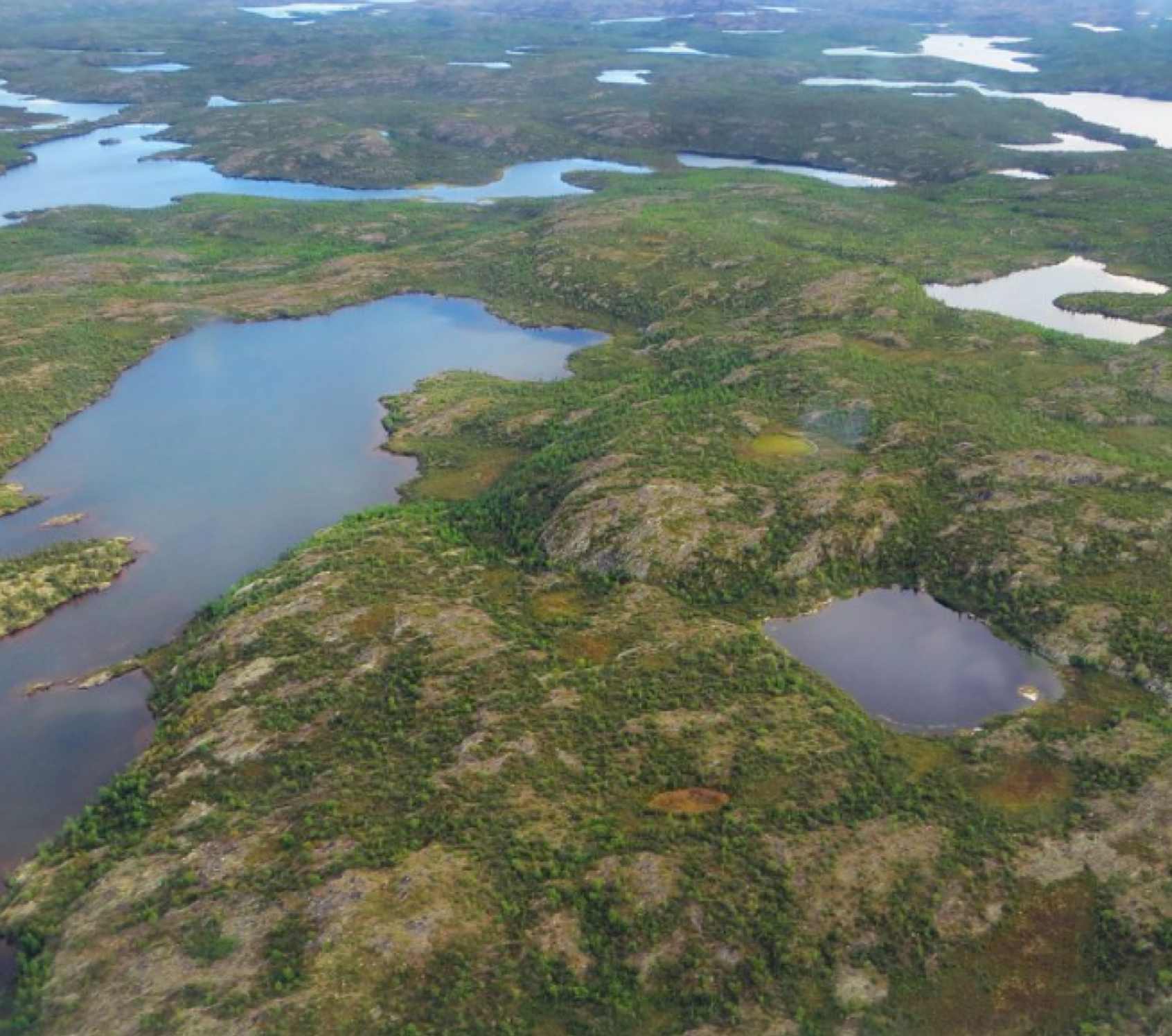
Managing and protecting a resource requires knowing what and, importantly, where it is. With interests in an area greater than 55 million hectares, home to 5 Indigenous communities, the Treaty 8 Tribal Corporation (“Akaitcho”) needed high- tech support when they launched a planning process to manage boreal wetlands. Through a partnership with Ducks Unlimited Canada and with a focus on satellite mapping linked to traditional knowledge, they were able for the first time to map all of their lands, both wet and dry.
Background
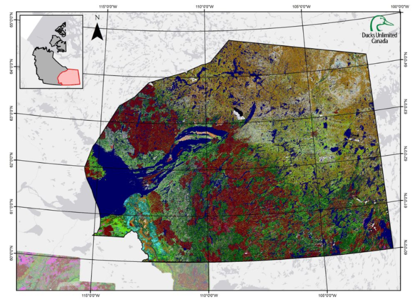
The best ideas are often the most simple. When they launched a territory-wide landuse plan, leaders from the Treaty 8 Tribal Corporation recognized the need for an up-to-date map of the area. They turned to Ducks Unlimited Canada’s wetland specialists to develop a multi-year mapping project unlike any other the region has ever seen. Combining millennia of cultural knowledge of the land and high-resolution satellite imagery, the team mapped 55 million hectares of Akaitcho Traditional Territory. This map now serves as a baseline to monitor climate change and support Akaitcho Dene’s land-use decisions on their traditional territories. The Akaitcho Dene’s First Nation Wetland Mapping project is a milestone in both Ducks Unlimited Canada’s mapping program and in the Akaitcho Dene’s path toward self-determination over their ancestral homeland. It also demonstrates how strong partnerships promote EBM through collaboration and mutual respect.
Innovation
Without knowing what is on the land, satellite images are just colourful pictures. Add knowledge and they become powerful tools that can foster EBM over vast areas. And while the tools are easy to use, gathering this knowledge can be difficult and expensive. Especially over 55 million square kilometers of pristine wetlands. But this was not a problem for the Akaitcho. They’ve been on the land for thousands of years and are able to point to a satellite image and describe, with a rich history and deep understanding, what is there. This two-year partnership created an innovative map that reflected generations of understanding of this unique northern landscape.
“ This two-year partnership was able to create an innovative map reflecting generations of understanding of this unique northern landscape.”
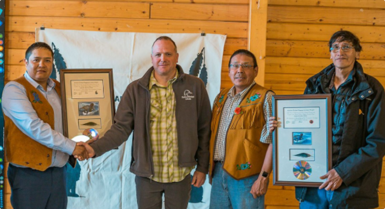
Kevin Smith (DUC) presents appreciation plaques to the Treaty 8 Tribal Corporation at the Akaitcho General Assembly.
From (L), Chief Edward Sangris, Chief Darryl Boucher-Marlowe, Kevin Smith, Chief Ernest Betsina, and Councillor Pat Simon
Discovery
Although the project set out to create a wetland map, the final product achieved much more. It identified every wetland and terrestrial habitat over the entire Akaitcho region. And, by training local technicians to use this as a digital resource, the map is a way for the Akaitcho First Nation to predict future effects of landuse and climate change. Already, land-use decisions are being made to promote traditional ways of life on the land — home to over 500 birds, fish and mammal species — in Fort Resolution, it is being used to establish an Indigenous Protected and Conserved Area around the Slave River delta and Taltson River.
Where in the wheel?
EBM is very relevant to land use planning and management. Gathering knowledge from diverse sources, including an array of ecosystem components in the planning process and making inclusive decisions enable ecosystem based outcomes. The collaborative process that led to the success of this project lends unique credibility to the final product. The ability to locate and quantify resources will make planning for EBM outcomes in this region possible for a very long time.